Series description
Following the Seoul Fortress Plan of the late 1960s, extensive barriers were constructed in South Korea to halt a North Korean armoured advance, expanding through the late Cold War. Landmines were widely deployed to block infiltration, forming what was believed to be an impassable ‘no man’s land’. While researching various collapses and fatal explosions, the photographer recognised a contradiction; he explains that ‘past security logic endangers the present’. Leaving military school, he began constructing a photographic cartography of these Cold War peripheries, and traced the river systems of the Han, Imjin, and Hantan Rivers, areas where lost landmines remain buried, moving upstream through the Western and Central Fronts to photograph the anti-tank obstacles and minefields that remain.
Untitled
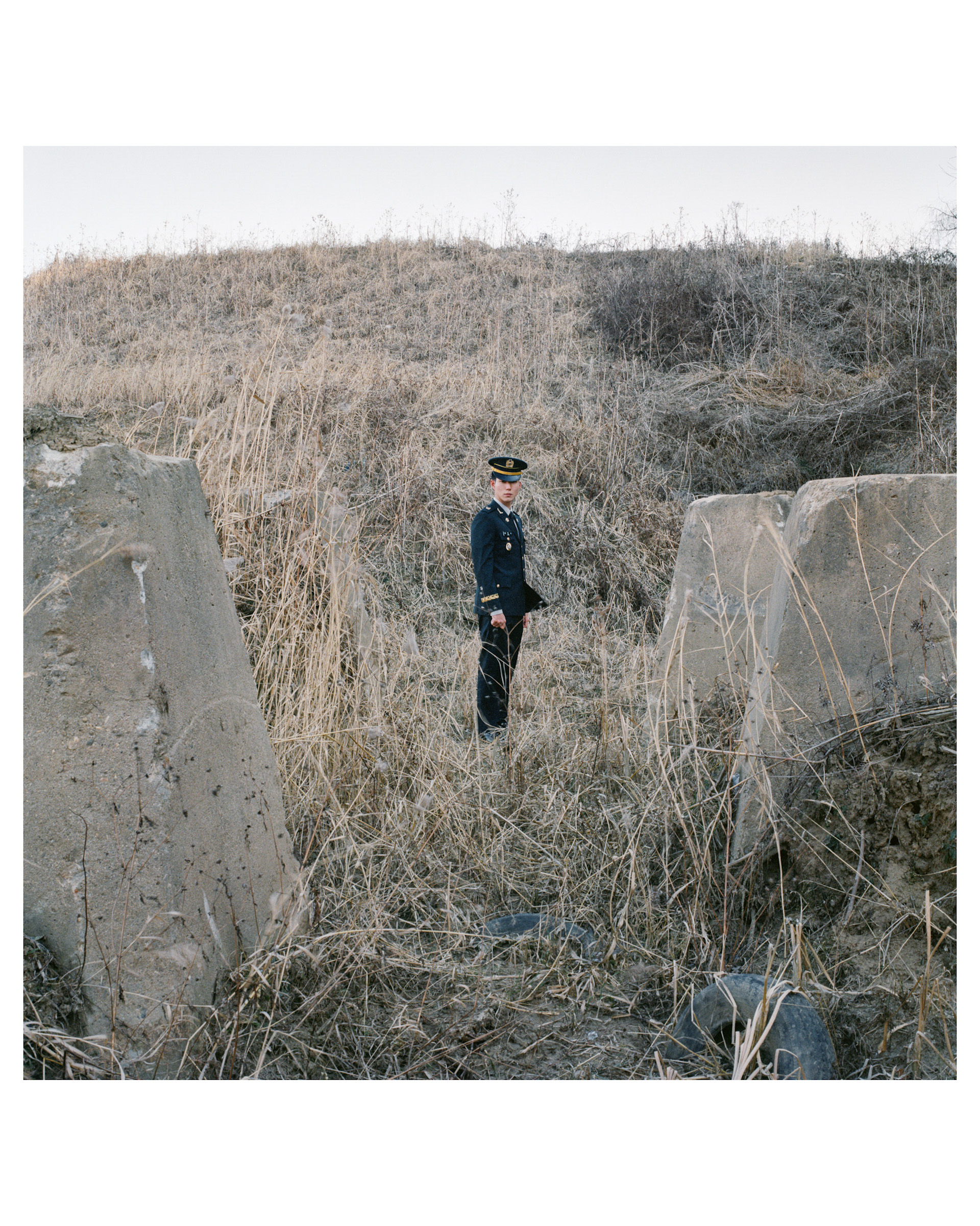
A friend that the photographer met at military school became a soldier, and was assigned to an armoured unit stationed along the inter-Korean border.
© Ye Hyun Kim, Korea, Republic Of, Shortlist, Professional Competition, Documentary Projects, 2026 Sony World Photography Awards
Untitled
During South Korea’s period of economic development, the outskirts of the capital pushed further outwards. Today, Seoul’s overcrowding has led to the construction of numerous new towns on its periphery, which exist alongside minefields.
© Ye Hyun Kim, Korea, Republic Of, Shortlist, Professional Competition, Documentary Projects, 2026 Sony World Photography Awards
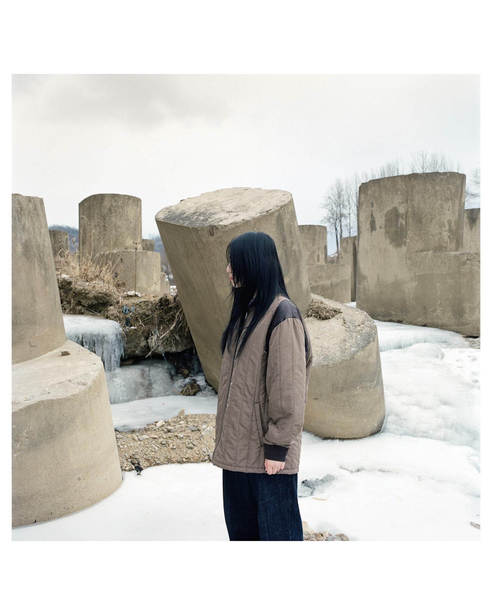
Untitled
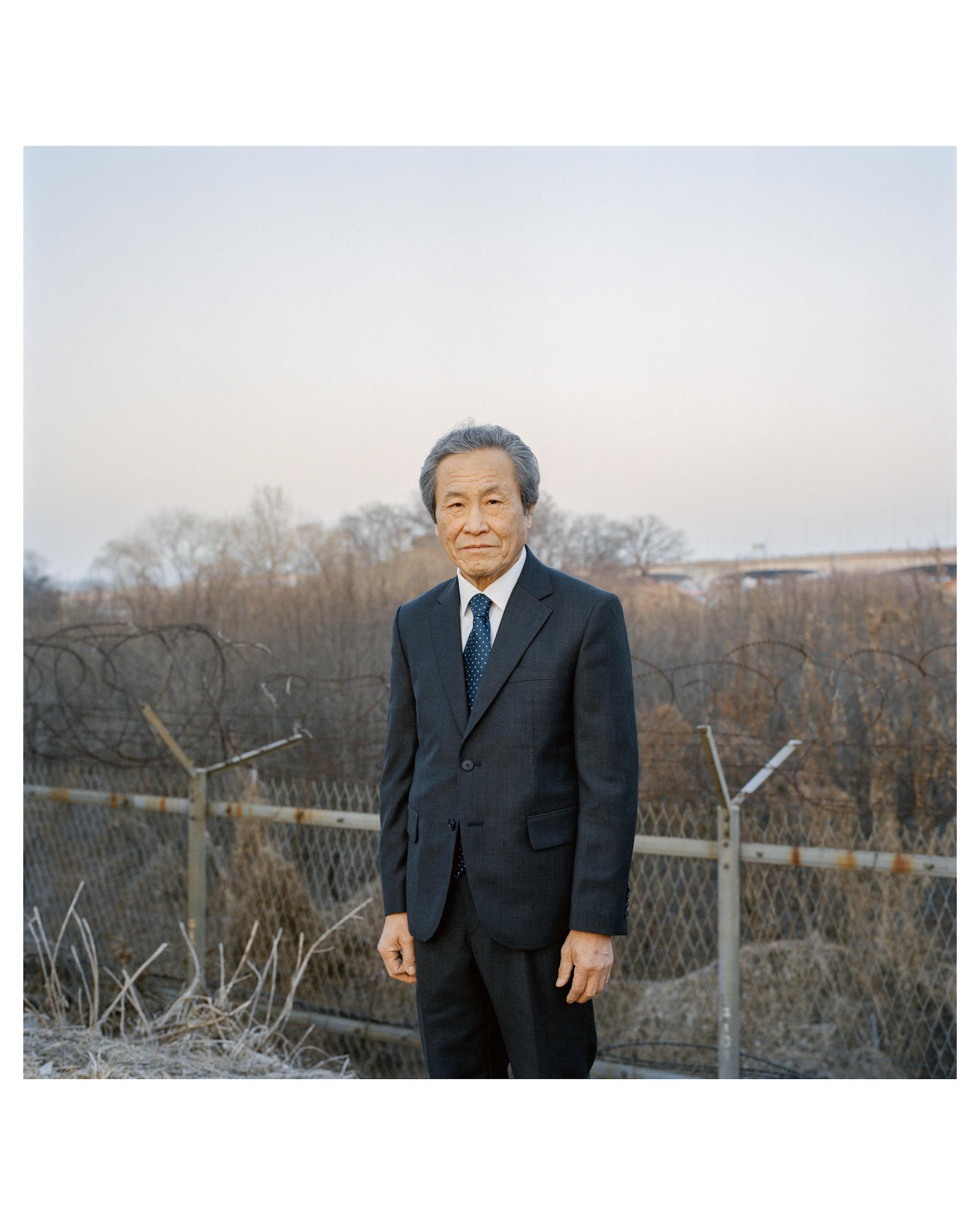
Along the rivers of the inter-Korean border live the people pushed to the margins of Seoul and the city’s everyday life. After this man’s business collapsed, he built a container home near a minefield where he now lives in quiet seclusion.
© Ye Hyun Kim, Korea, Republic Of, Shortlist, Professional Competition, Documentary Projects, 2026 Sony World Photography Awards
Untitled
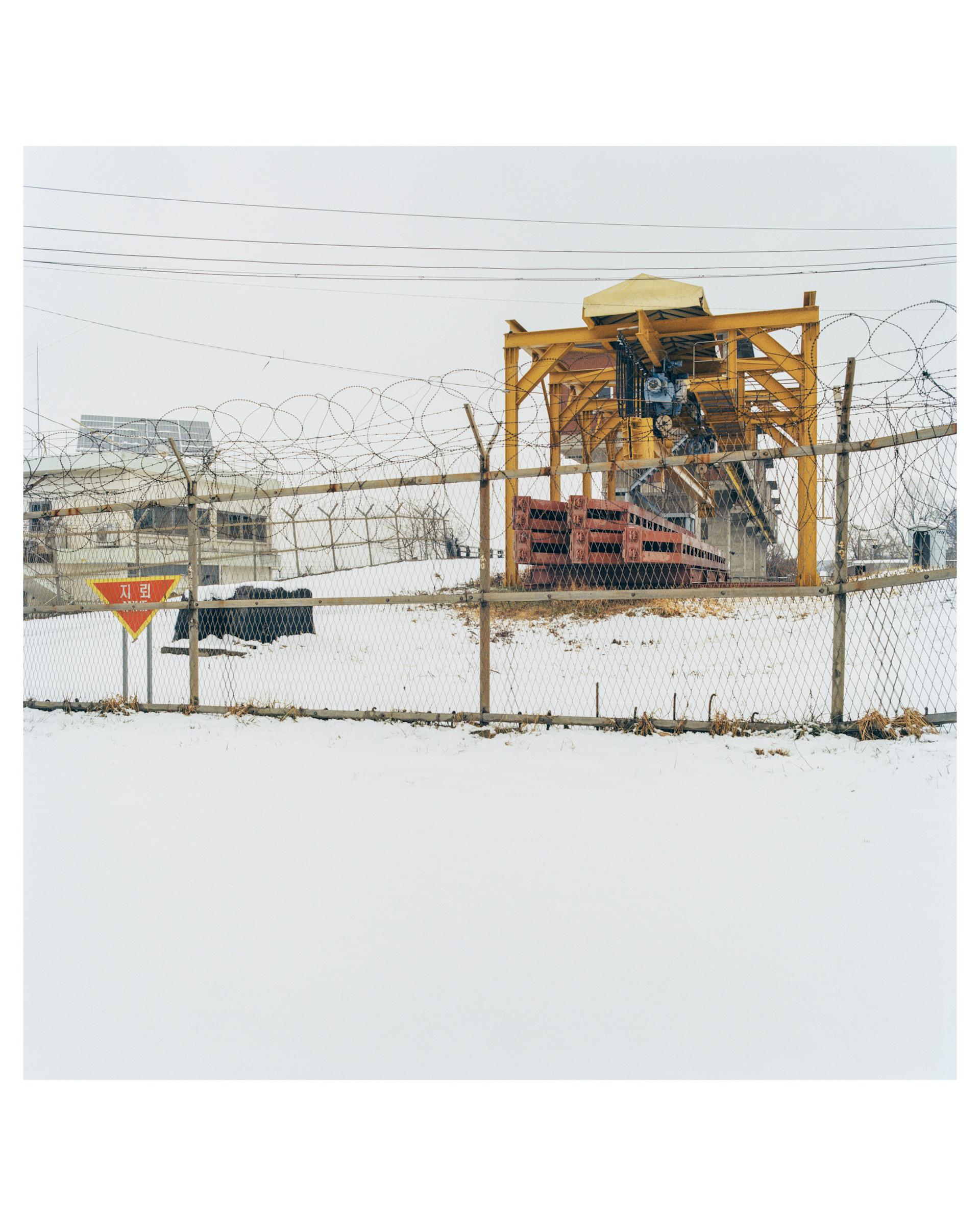
Numerous lost landmines remain along the rivers of the border region and tourists often enter these areas unaware of their presence. At times, explosions occur, resulting in casualties.
© Ye Hyun Kim, Korea, Republic Of, Shortlist, Professional Competition, Documentary Projects, 2026 Sony World Photography Awards
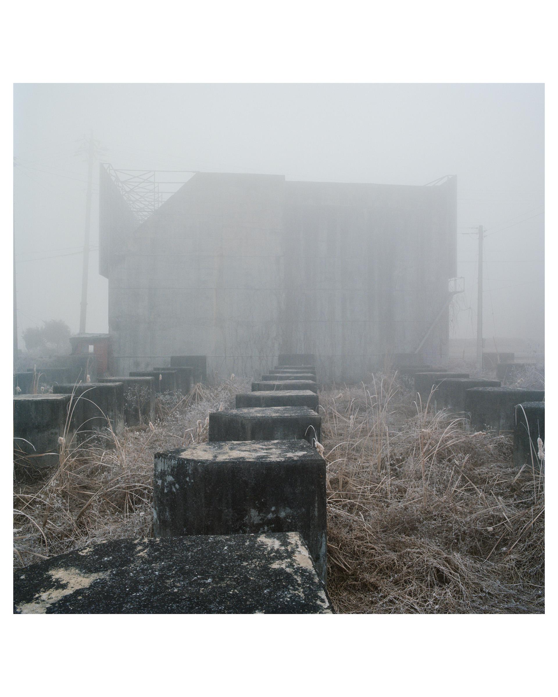
Untitled
Anti-tank obstacles that were once built for war can cause traffic accidents when fog descends. The photographer explains that structures erected for past conflicts are now killing people in the present.
© Ye Hyun Kim, Korea, Republic Of, Shortlist, Professional Competition, Documentary Projects, 2026 Sony World Photography Awards
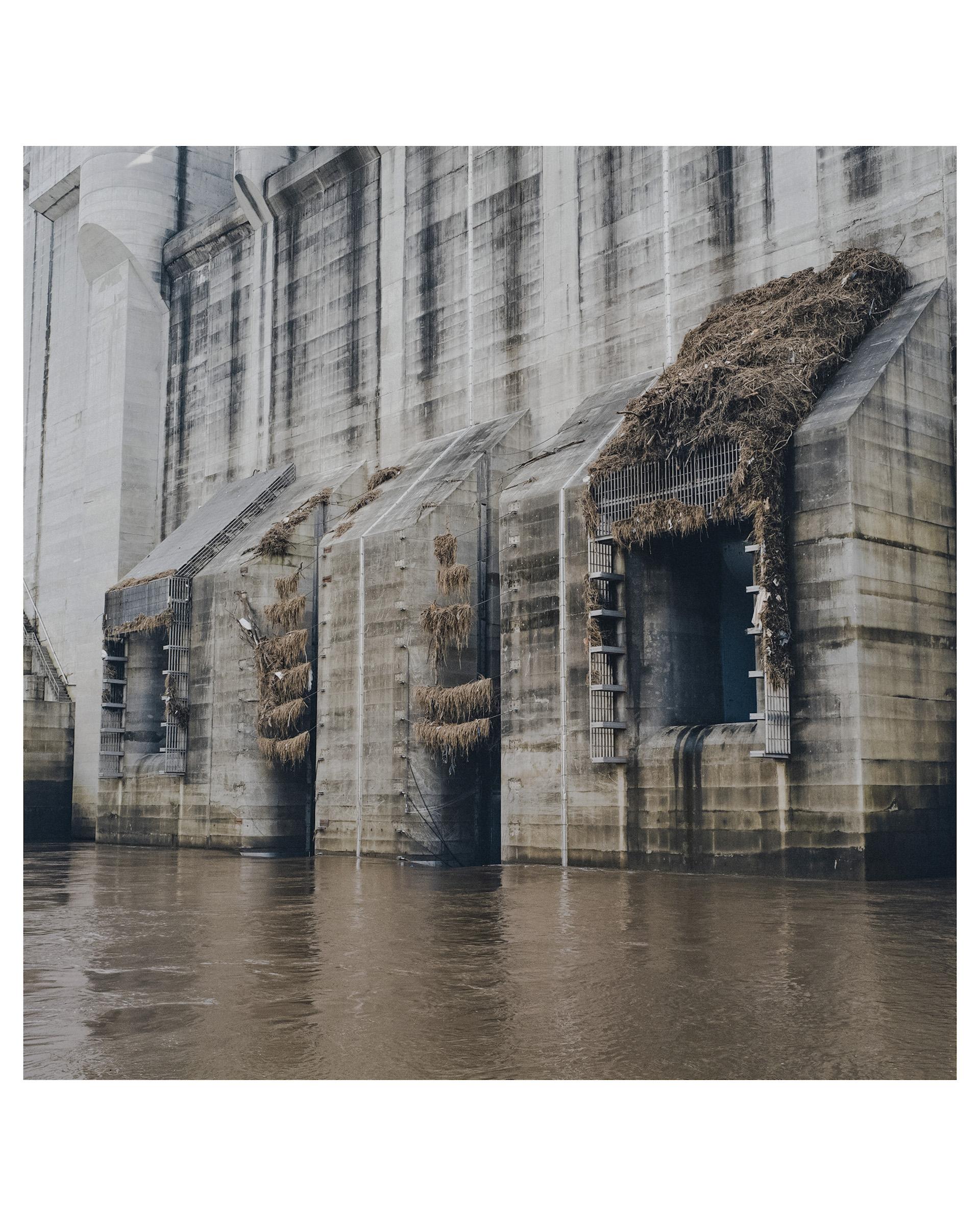
Untitled
South and North Korea share the Hantan and Imjin Rivers as transboundary waterways. When the North releases water from its dams, the southern terrain is submerged. Lost landmines can become trapped in vegetation and the floodgates in the process.
© Ye Hyun Kim, Korea, Republic Of, Shortlist, Professional Competition, Documentary Projects, 2026 Sony World Photography Awards
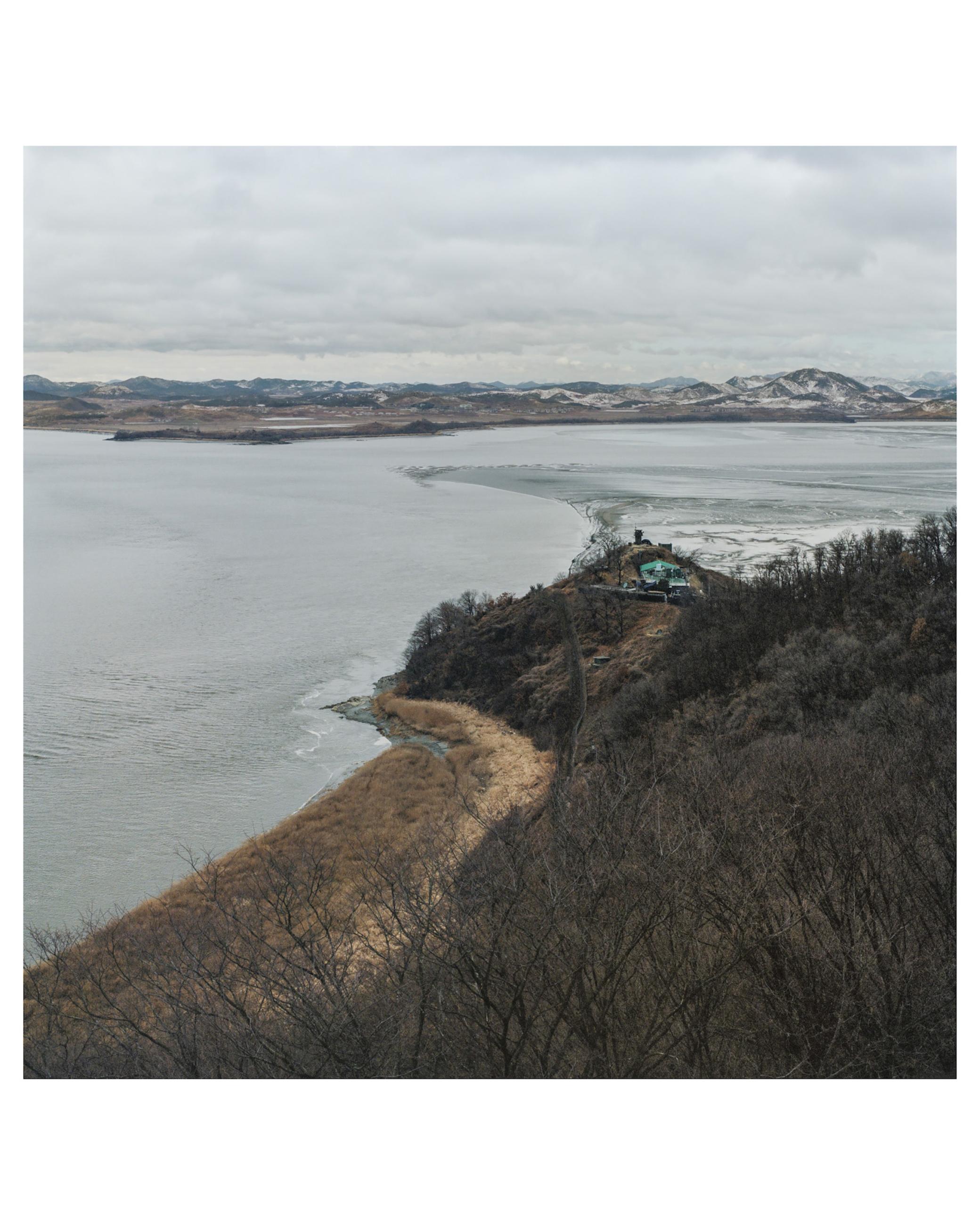
Untitled
‘Across a single river, countless concepts and ideologies collide. Beneath one shared ethnicity, lives unfold in radically different forms.’
© Ye Hyun Kim, Korea, Republic Of, Shortlist, Professional Competition, Documentary Projects, 2026 Sony World Photography Awards