
Series description
Over 30 years have passed since the Dayton Agreement was signed and a 1,080-kilometre-long boundary line effectively divided Bosnia into two entities and one district. The photographer explains that ‘consciously or not, hatred is still passed on from generation to generation — a legacy from a war that is still fresh in people’s minds.’ Points of Impasse explores the lasting impact of the war and division on the people and places of Bosnia and Herzegovina. The project centres around a politically divided terrain that impacts individual and collective perceptions, ‘creating a space that cannot be separated from the holders of a shared identity.’
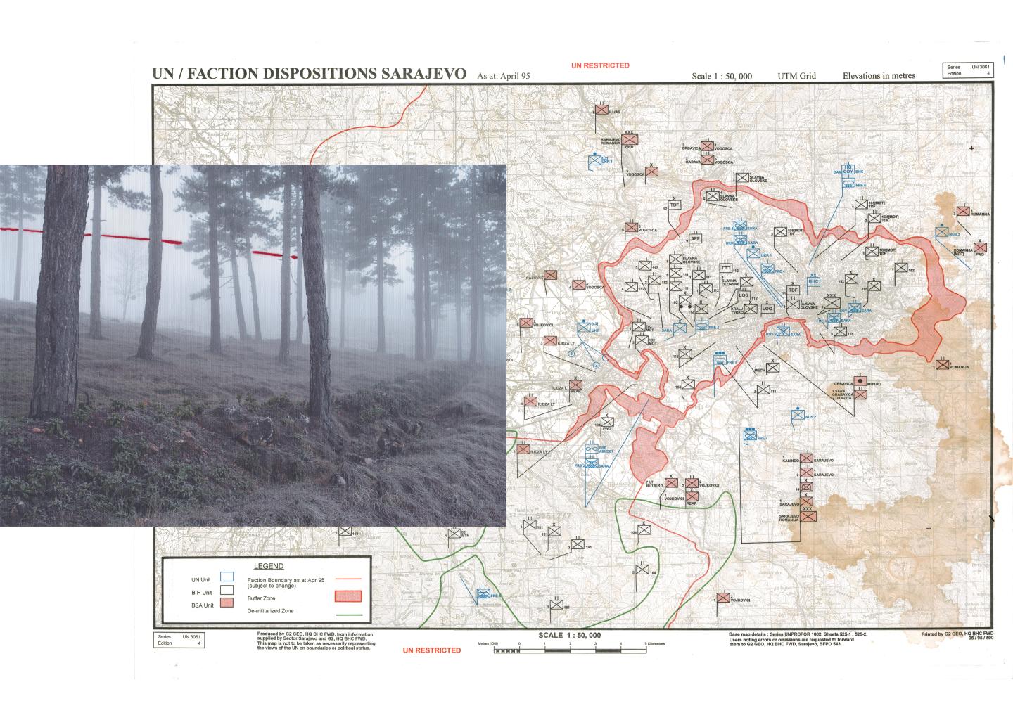
Left: Abandoned trenches at Zlatište, on the outskirts of Sarajevo, are a lasting reminder of the makeshift shelters created by defenders of the city. During the war, civilians turned soldiers dug the trenches. Right: A UN map titled Faction Dispositions — Sarajevo, April 1995 shows faction boundaries, buffer zones, and demilitarised areas in the city during the final months of the Bosnian War.
© Armin Graca, Bosnia And Herzegovina, Shortlist, Professional Competition, Creative, 2026 Sony World Photography Awards
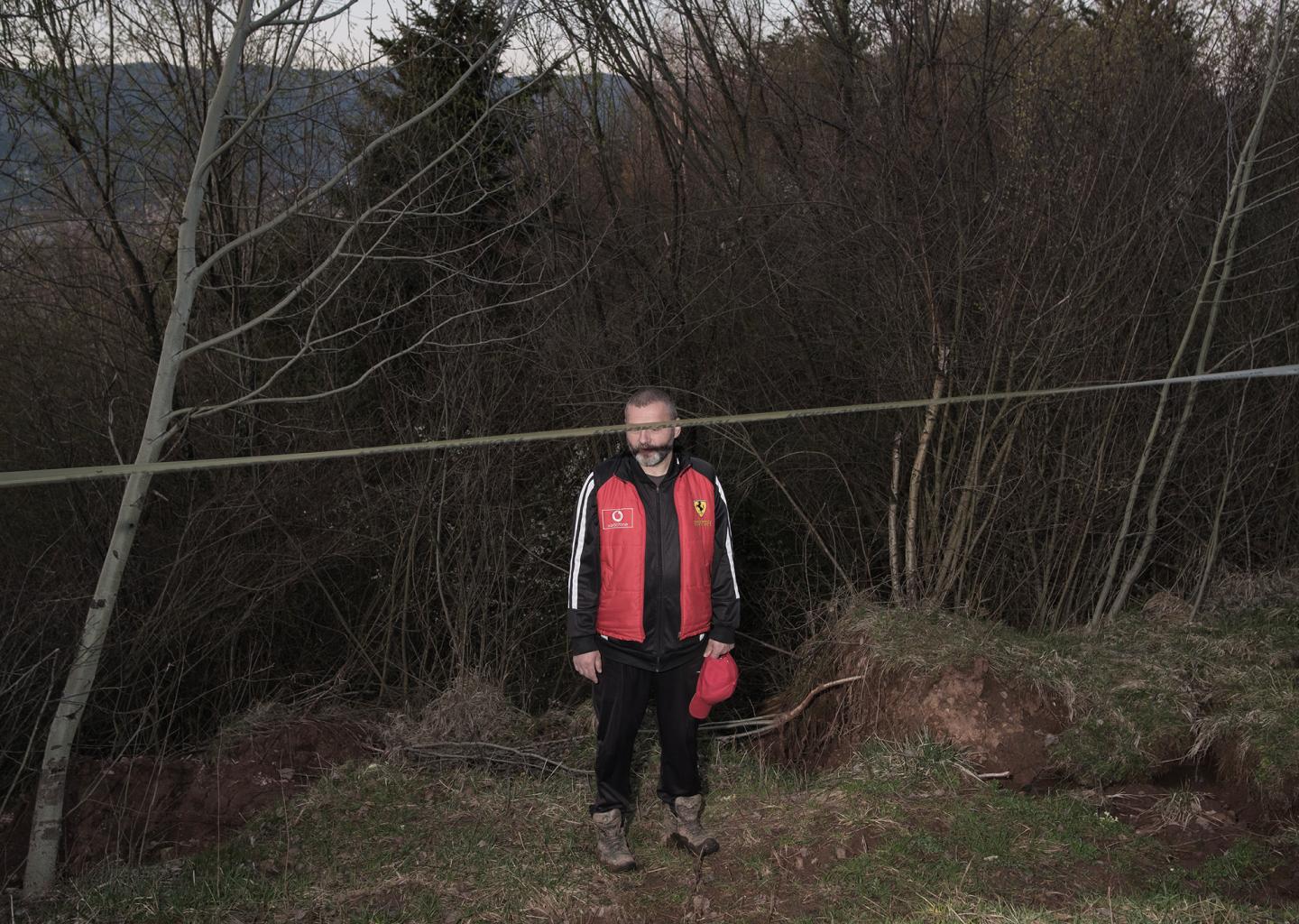
Samir Isaković, a council member from the local community of Širokača, stands at the site of the Curine Njive landslide, near the Inter-Entity Boundary Line. Triggered by deforestation and illegal dumping from multiple construction projects on Trebević in Republika Srpska, the landslide displaced more than 20 families and exposed the fragility of post-war governance, where overlapping jurisdictions hinder timely response.
© Armin Graca, Bosnia And Herzegovina, Shortlist, Professional Competition, Creative, 2026 Sony World Photography Awards
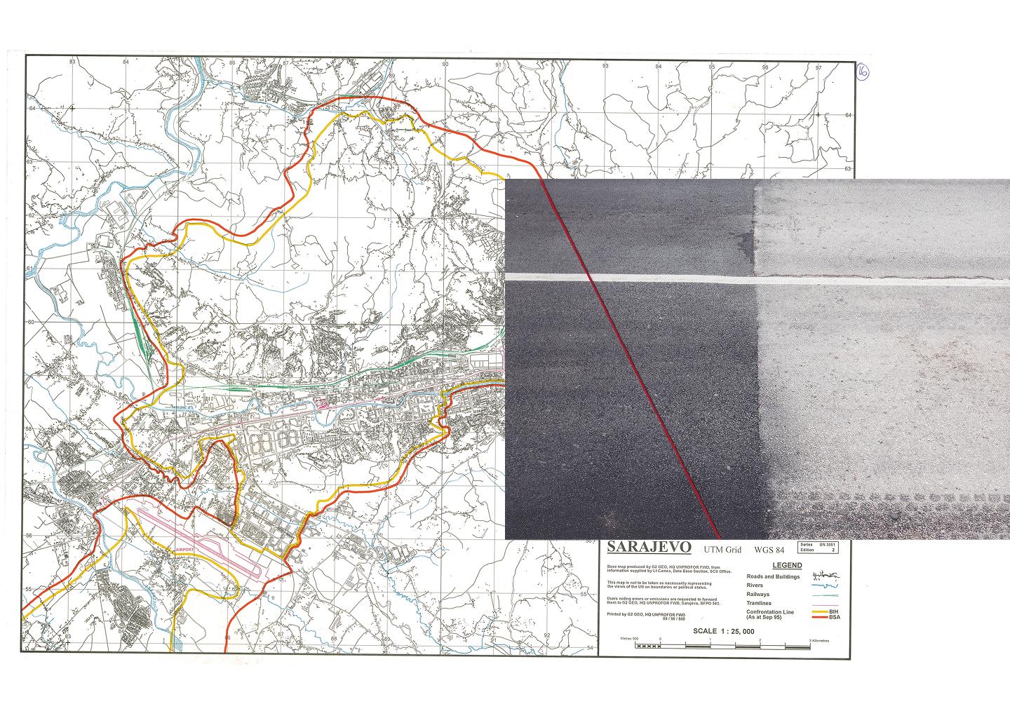
Left: A UN map of Sarajevo from September 1995 shows the confrontation lines separating the Bosnian Serb Army (red) and the Army of the Republic of Bosnia and Herzegovina (yellow). These positions closely mirror what would soon become the Inter-Entity Boundary Line under the Dayton Agreement.
Right: A half-repaved road near Vraca, Sarajevo marks the boundary line dividing the country into Republika Srpska, Federation of Bosnia and Herzegovina and Brcko District. The road is only partially repaved due to the ongoing inability of entities to collaborate on road maintenance.
© Armin Graca, Bosnia And Herzegovina, Shortlist, Professional Competition, Creative, 2026 Sony World Photography Awards
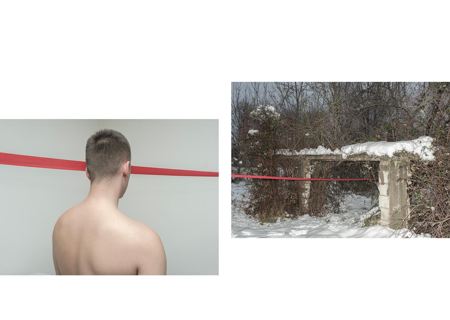
Left: An anonymous man poses for a portrait. As a teenager in the post-war years, he took part in cross-boundary clashes between youths from both sides.
Right: A snow-covered, abandoned building stands on the Inter-Entity Boundary Line in Dobrinja, Sarajevo. The red thread marks the exact path of the post-war dividing line, highlighting how the IEBL cuts through everyday spaces.
© Armin Graca, Bosnia And Herzegovina, Shortlist, Professional Competition, Creative, 2026 Sony World Photography Awards
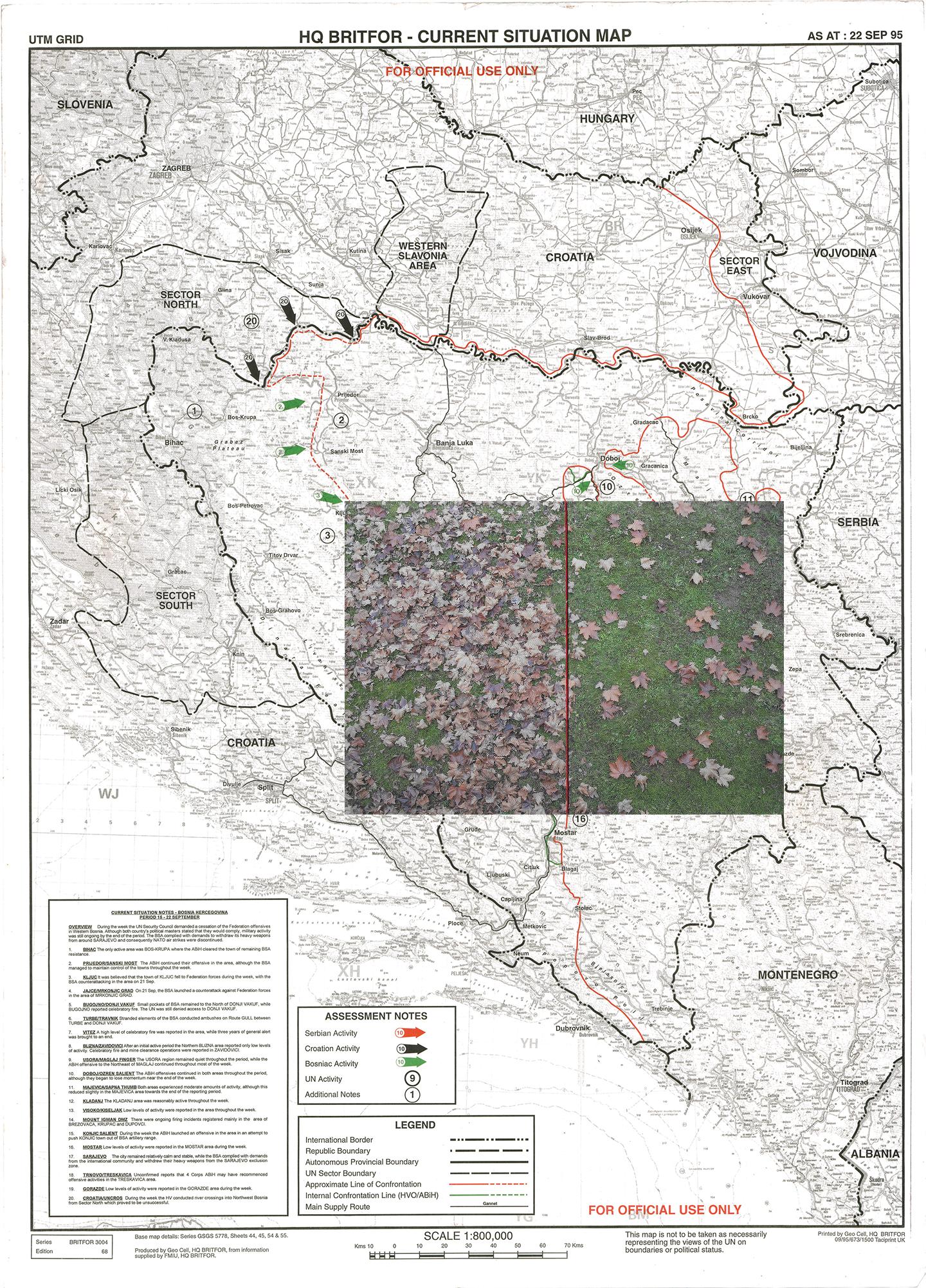
Centre: In Dobrinja IV, Sarajevo, fallen leaves were recently cleared along the side of a public garage that sits directly on the boundary. The maintenance of the garage and the surrounding area is a shared responsibility between the two jurisdictions, but only the Republic Srpska side was cleared, highlighting the ongoing challenges of managing public spaces in areas that remain divided by political and ethnic lines.
Background: A BRITFOR Current Situation Map dated 22 September 1995 depicts Bosnia and Herzegovina with a red line tracing the approximate confrontation line between opposing forces. These frontlines, documented weeks before the Dayton negotiations, would be transformed into the Inter-Entity Boundary Line.
© Armin Graca, Bosnia And Herzegovina, Shortlist, Professional Competition, Creative, 2026 Sony World Photography Awards
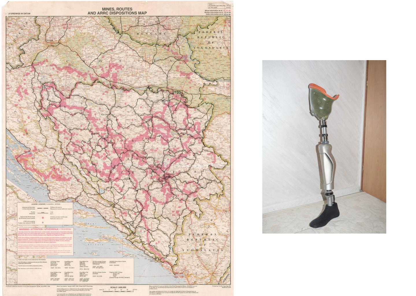
Left: A 1996 IFOR Mines, Routes and ARRC Dispositions map indicates approximate mined areas across Bosnia and Herzegovina. Many of these follow the Inter-Entity Boundary Line established after the Dayton Peace Agreement.
Right: A prosthetic leg in the apartment of its owner in Sarajevo. Bosnia and Herzegovina remains one of the most mine-contaminated countries in the world, with an estimated 180,000 landmines and explosive remnants still buried. Since 1996, more than 1,700 people have been killed or injured by landmines.
© Armin Graca, Bosnia And Herzegovina, Shortlist, Professional Competition, Creative, 2026 Sony World Photography Awards